

DJI
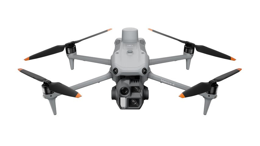
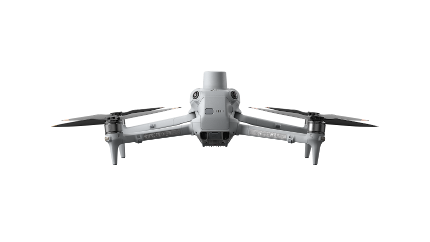
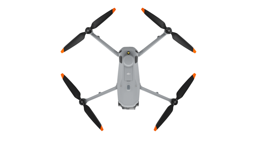
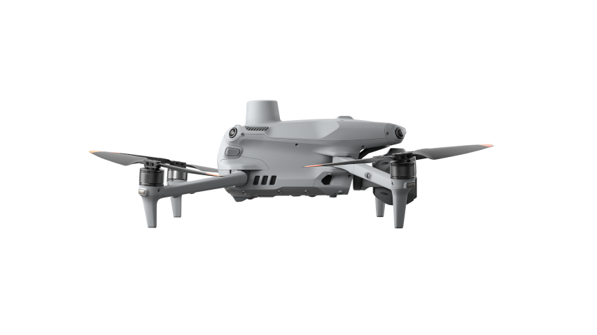
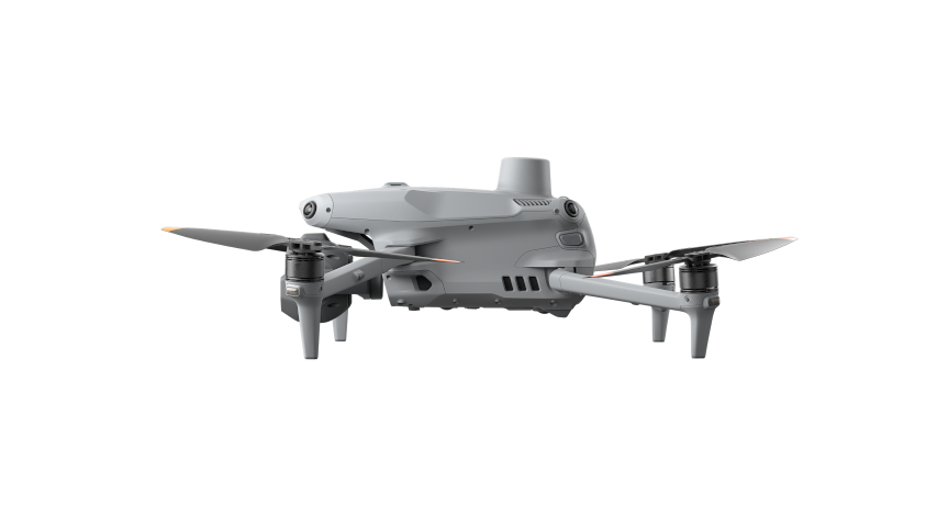
DJI Matrice 4E
DJI Matrice 4E
SKU:CP.EN.00000574.02
Couldn't load pickup availability
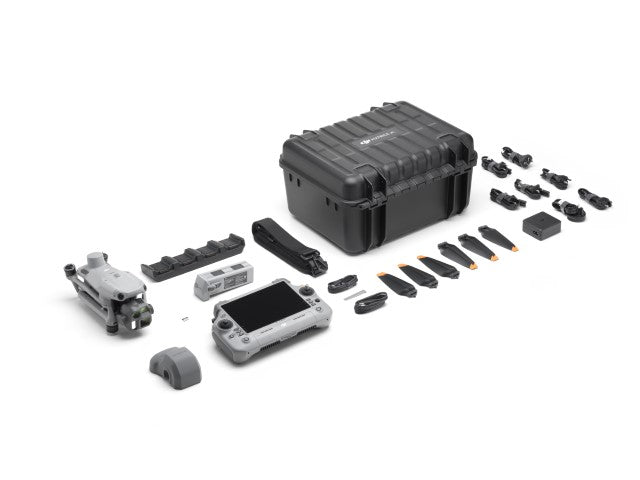
In The Box:
- DJI Matrice 4E
- DJI Matrice 4 Series Battery
- DJI RC Plus 2 Enterprise
- DJI 100W USB-C Power Adapter
- DJI Matrice 4 Series Charging Hub
- microSD Card
- DJI Matrice 4E Gimbal Protector
- DJI Cellular Dongle 2 Pry Bar
- 3x DJI Matrice 4 Series Propellers
- 100W Power Adaptor AC Cable
- USB-C to USB-C Data Cable
- USB-A to USB-C Data Cable
- DJI Matrice 4 Series Storage Case
- DJI Matrice 4 Series Storage Case Shoulder Strap
A Specialized Tool for Surveying and Mapping
The DJI Matrice 4E (M4E) is expertly crafted to meet the needs of geospatial professionals. Its innovative design and cutting-edge features simplify surveying and mapping processes, delivering enhanced accuracy, efficiency, and user-friendly operation.
Key Features for Mapping and Surveying:
1. Efficiency
-
-
Extended Flight Duration: The M4E offers an impressive maximum flight time of 49 minutes when paired with an RTK module, surpassing previous models. This extended duration allows for longer operations and minimizes the frequency of battery replacements.
- Multi-Directional Imaging: Equipped with 3-directional ortho capture and 5-directional oblique capture, the M4E boosts mapping efficiency by up to 40% over conventional methods.
- Rapid Imaging: Captures images at intervals as brief as 0.5 seconds, enabling fast mapping of extensive areas.
-
Extended Flight Duration: The M4E offers an impressive maximum flight time of 49 minutes when paired with an RTK module, surpassing previous models. This extended duration allows for longer operations and minimizes the frequency of battery replacements.
2. Advanced Precision Technology
-
- Distortion Correction 2.0: An enhanced correction system reduces residual distortion to under 2 pixels, ensuring outstanding imaging accuracy. Factory-calibrated cameras, combined with DJI Terra software, provide highly accurate 3D reconstructions.
- RTK Precision: Real-time kinematic (RTK) capabilities offer centimeter-level accuracy for highly precise georeferencing.
3. Streamlined Operations
-
- Smart 3D Capture: Seamlessly integrated with DJI Terra on the remote controller, it enables users to effortlessly generate mapping routes and create detailed 3D models without the need for external devices.
- Obstacle Avoidance: Advanced sensors allow the drone to safely navigate through complex environments, making close-range inspections and modeling easier to manage.
DJI Matrice 4 Series: Redefining the Standard for Enterprise Drones
The DJI Matrice 4 Series transforms the enterprise drone landscape by merging a compact design, smart features, and unmatched versatility. This advanced collection includes two leading models: the Matrice 4T and Matrice 4E, tailored to meet the specific needs of diverse industries. Equipped with state-of-the-art AI technology and a precision laser rangefinder, the series delivers outstanding performance, safety, and operational efficiency, positioning it as a groundbreaking solution for businesses in search of cutting-edge drone technology.
Key Features of the Matrice 4 Series:
1. Advanced AI and Sensors
-
- Advanced detection systems provide improved precision and safety with every flight.
- With integrated AI capabilities, the Matrice 4 Series enables real-time data processing, enhancing operational efficiency and lightening the human workload.
2. Optimized Accessories
-
- The enhanced accessories are crafted to optimize functionality and expand on the capabilities of the drones, supporting a broad array of enterprise applications.
3. Specialized Models for Specific Needs
-
-
Matrice 4E: Designed for geospatial applications such as surveying, mapping, construction, and mining.
- Matrice 4T: Ideal for industries including emergency response, utilities, public safety, and forestry conservation.
-
Matrice 4E: Designed for geospatial applications such as surveying, mapping, construction, and mining.
The Matrice 4 Series is the perfect solution for businesses looking to boost workflow efficiency, improve safety, and explore new opportunities in aerial operations.
Suggested Applications for the Matrice 4E
1. Broad-Scale Mapping Projects
-
-
Advantages:
- Longer flight time minimizes operational downtime.
- Multi-directional and high-speed imaging enhances productivity.
- Perfect for surveying and planning organizations, urban development teams, and government initiatives.
-
Advantages:
2. Elaborate Structure Modeling
-
-
Advantages:
- Intelligent 3D capture guarantees precise models of structures.
- Sophisticated obstacle avoidance ensures safe operation in tight or complex environments.
- Ideal for architectural design firms, conservation groups, and fire departments handling structural assessments.
-
Advantages:
3. Surface and Asset Evaluations
-
-
Advantages:
- Triple telephoto cameras deliver high-resolution visuals for close-range inspections.
- Vision positioning enables safe operation in areas with limited GNSS signal.
- Tailored for industries like infrastructure maintenance, bridge inspections, and powerline evaluations.
-
Advantages:
Share