DJI
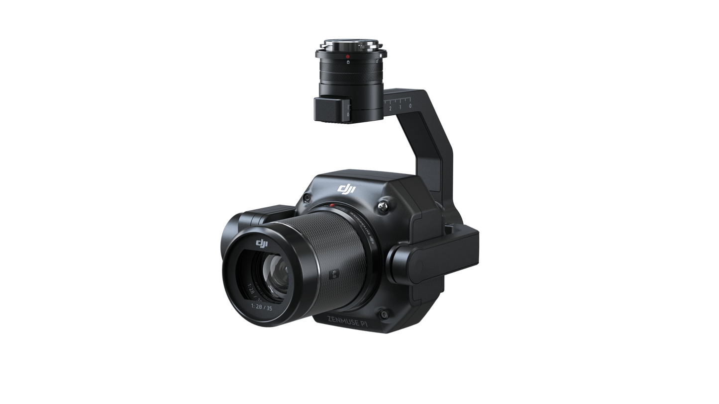
Zenmuse P1
Zenmuse P1
SKU:CP.ZM.00000136.01
Couldn't load pickup availability
Product Highlights:
- 45MP Full-Frame Image Sensor
- Interchangeable fixed-focus lenses
- Global Mechanical Shutter with a 1/2000 Second Shutter Speed
- Smart Oblique Capture Feature
- TimeSync 2.0 Synchronization
- 3-Axis Stabilized Gimbal
- Smart Oblique Capture
The Zenmuse P1 features a Full-Frame Image Sensor that is 7.5 times larger than the Phantom 4 RTK Image Sensor and 1.8 times larger than the Zenmuse X7, offering the highest dynamic range and resolution among all DJI cameras.
Equipped with the DJI DL Mount, the P1 supports a variety of fixed-focus lens options, including 24mm, 35mm, and 50mm DJI DL lenses. Additionally, the P1 is designed with a Global Mechanical Shutter and boasts a shutter speed of up to 1/2000 second.
Generate 2D, 3D, and detailed models using the integrated 3-axis gimbal, which is compatible with 24/35/50 mm lenses, alongside the Smart Oblique Capture feature. With the P1, you can cover 7.5 sq.km in a single day, achieving a GSD of 3 cm and an 80% front overlap and 60% side overlap. Enhance the efficiency of your oblique photography mission by utilizing Smart Oblique Capture, which automatically adjusts the gimbal to capture images from various angles as needed.
The filesystem efficiently organizes all captured data, automatically linking files to the project name and time. For easier access, all GNSS data, timestamps, and MRK files are stored in a centralized location within the system. The image metadata contains comprehensive details about the camera's internal and external parameters, such as location, heading, camera angle, RTK status, and more. This simplifies and enhances the post-processing workflow.
Using the Zenmuse P1, users can generate 2D Orthomosaics without requiring Ground Control Points (GCPs), making it perfect for medium to large-scale operations.
Additionally, you can capture oblique images from various angles needed for 3D modeling, supporting 3D reality models and smart city planning for industries like urban design and detailed cadastral surveys at centimeter-level precision.
Share