

DJI
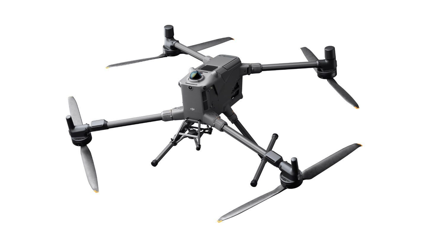
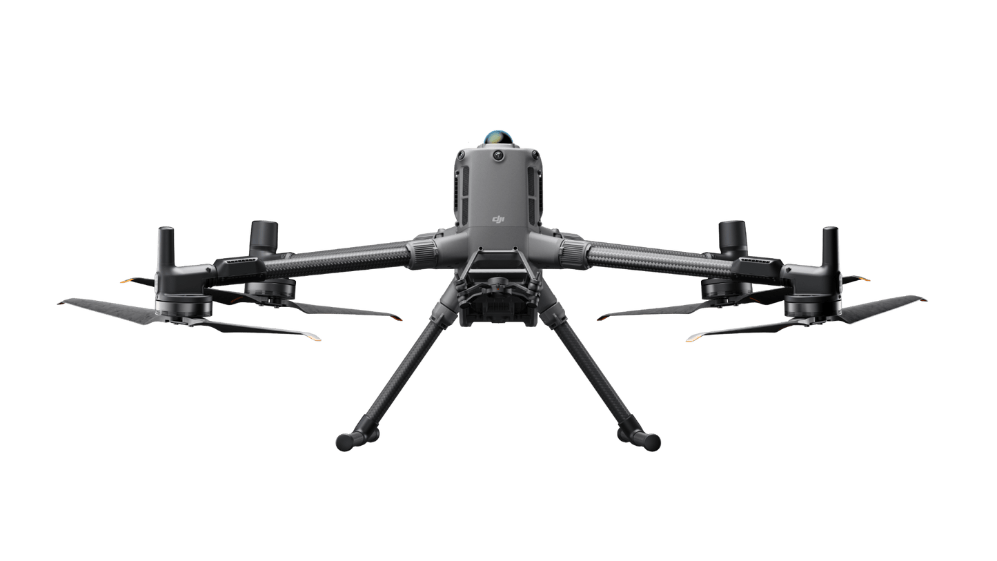
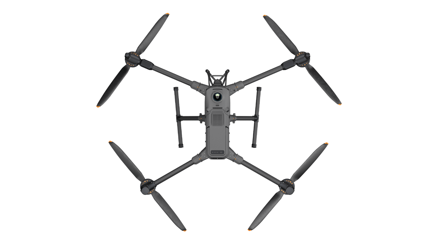
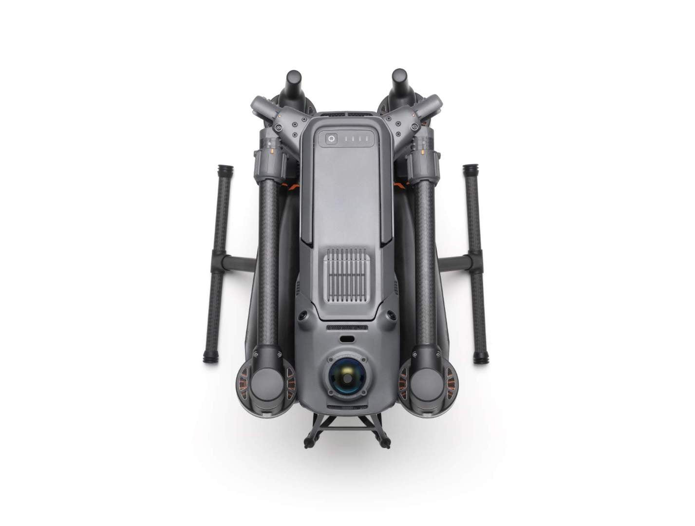
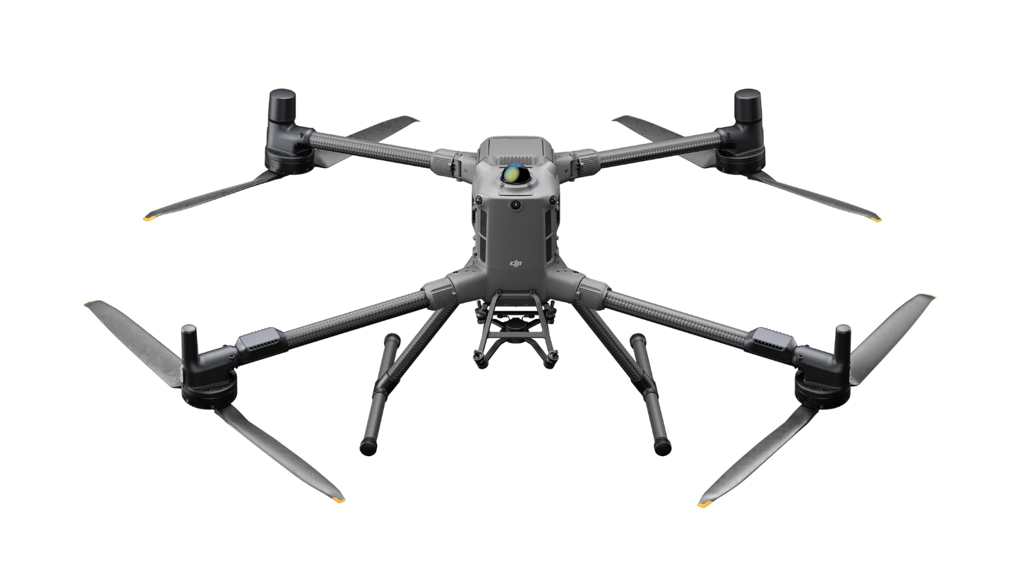
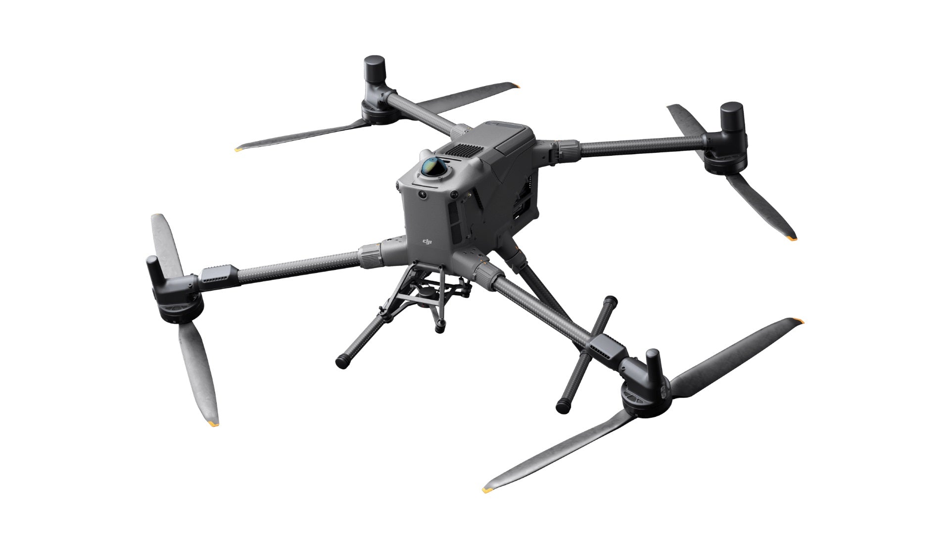
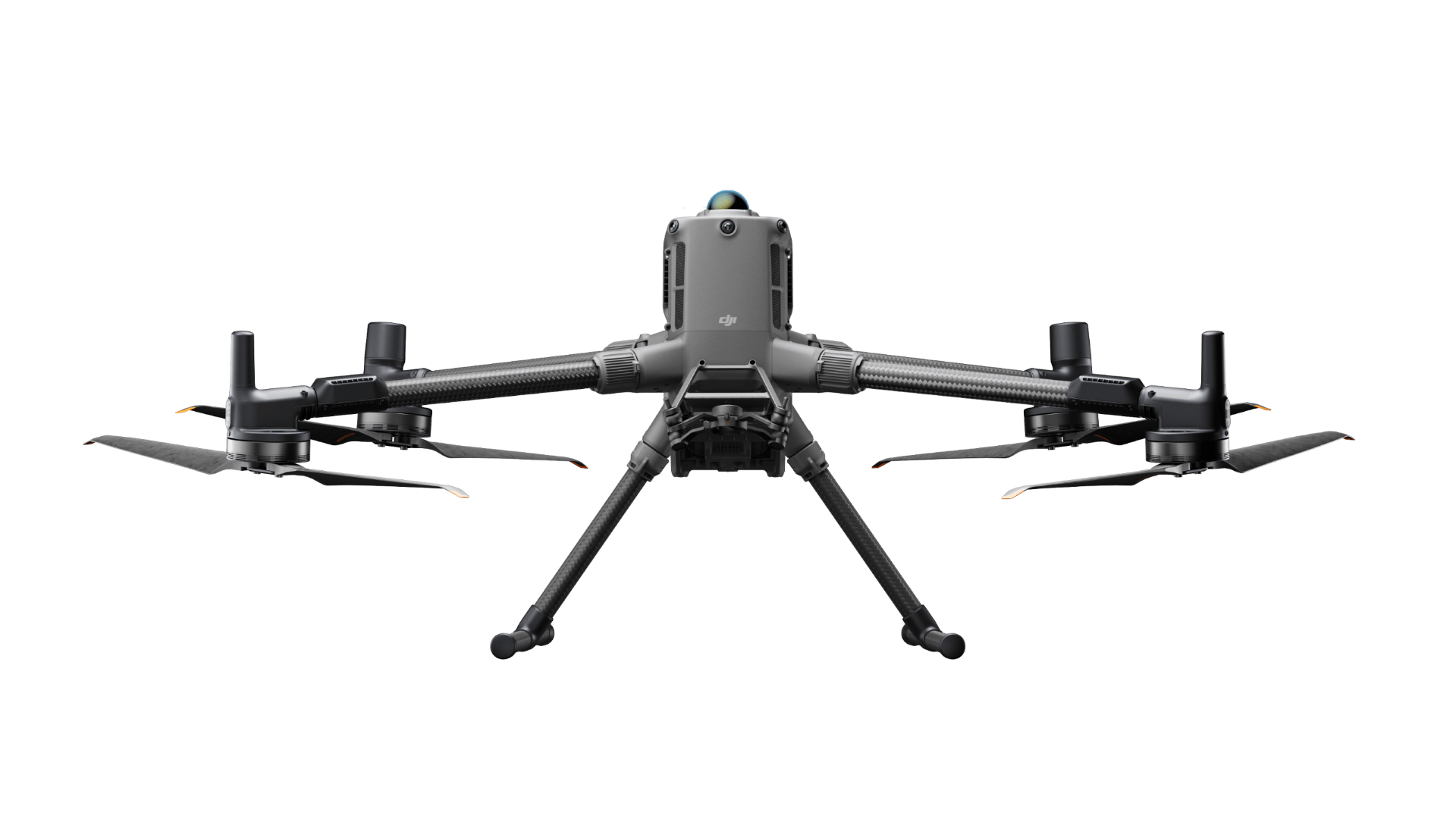
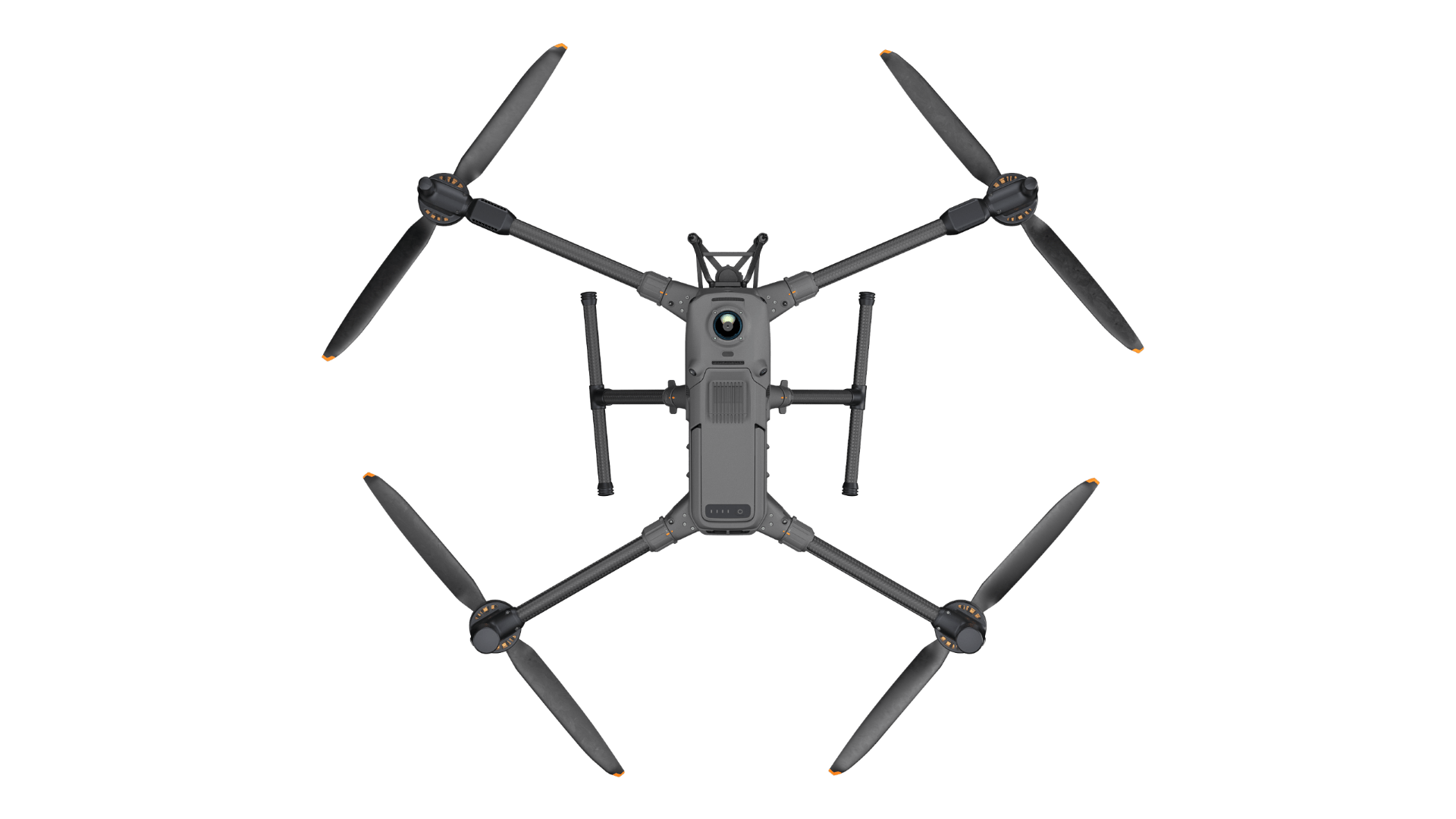
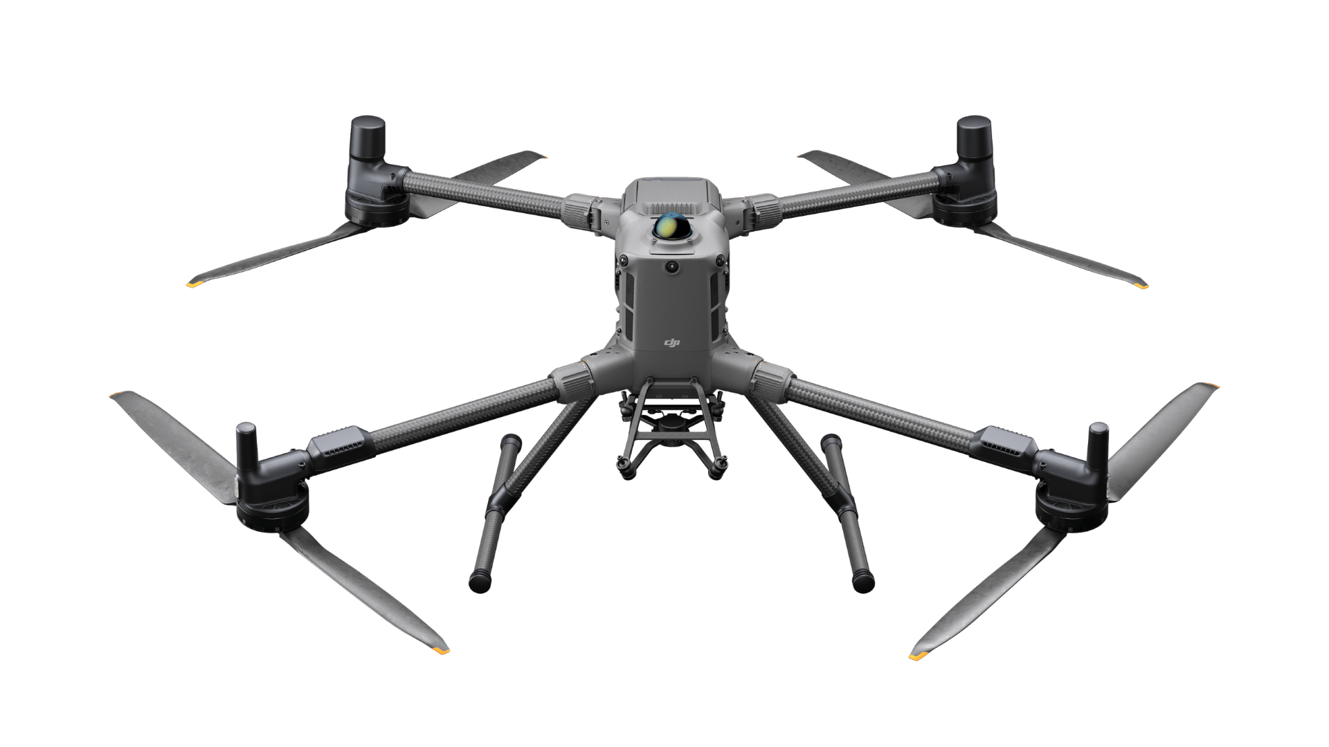
DJI Matrice 400
DJI Matrice 400
SKU:CP.EN.00000667.01
Couldn't load pickup availability
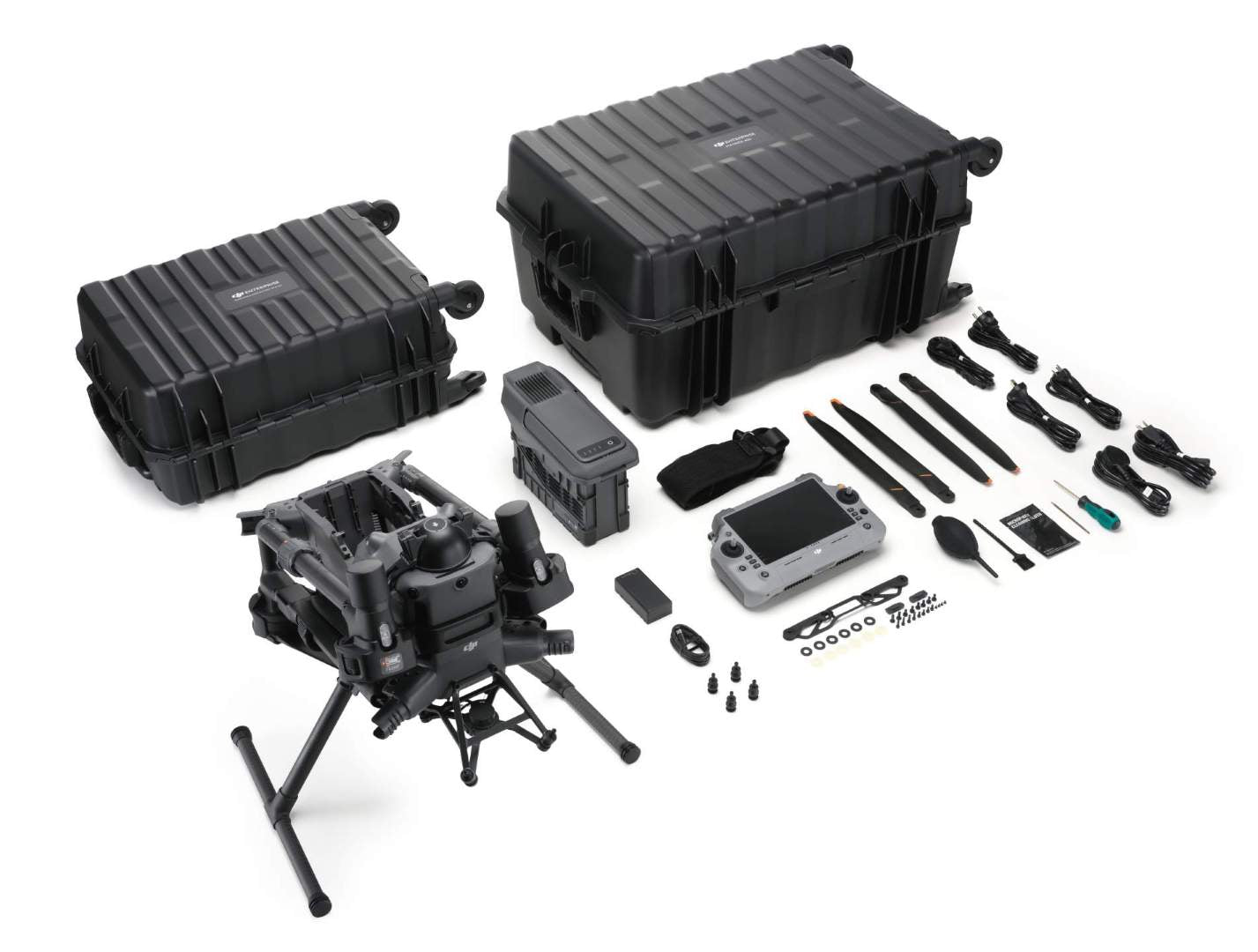
In the Box:
- Matrice 400 with DJI Care Enteprise Plus
- BS100 battery station
- TB100 battery x1
DJI Matrice 400
Engineered for Excellence, Designed for Versatility
The DJI Matrice 400 ushers in the next evolution of enterprise drone technology, redefining endurance, payload versatility, obstacle detection, and automation. With a flight time of up to 59 minutes, capacity for payloads up to 6 kg, and advanced power-line-level obstacle avoidance powered by integrated rotating LiDAR, mmWave radar, and low-light fisheye sensors, the Matrice 400 is built for professionals who require peak performance, unwavering reliability, and seamless scalability in the most challenging conditions.
Whether you're performing intricate power line inspections, advanced mapping missions, extensive search and rescue operations, or comprehensive industrial infrastructure surveys, the Matrice 400 is a dynamic platform designed to meet your operational demands while still ensuring superior safety, intelligence, and data accuracy.
Performance That Drives Innovation
Prolonged Flight Duration with Practical Payload Capacity
Equipped with an optimized powertrain and advanced energy management, the Matrice 400 delivers up to 59 minutes of forward flight and up to 53 minutes of hover time, even with payloads onboard. This extended endurance allows professionals to maximize mission coverage, reduce downtime between battery swaps, and enhance operational efficiency across industries such as emergency response, geospatial mapping, and environmental monitoring.
- Maximum forward flight time: 59 minutes
- Maximum hovering time: 53 minutes
- Top flight speed: 25 m/s
- Maximum payload capacity: 6 kg
Adaptable Payload System for Multi-Mission Versatility
Designed for adaptability, the Matrice 400 supports a diverse range of payloads and mission-specific tools, ensuring seamless adjustments to various operational demands. The platform accommodates a single or dual downward gimbal setup and features a third gimbal port for expanded versatility. Additionally, its four E-Port V2 interfaces enable simultaneous operation of up to seven payloads, including DJI native sensors, third-party devices, and onboard computing modules.
Supported payloads include:
Zenmuse H30 Series
A fully integrated multi-sensor payload featuring a wide-angle camera, zoom camera, infrared thermal imager, laser rangefinder, and NIR auxiliary light. Optimized with intelligent imaging algorithms, it ensures reliable performance in all weather conditions and enhances object detection capabilities day and night.
Zenmuse L2
Equipped with a powerful LiDAR module, high-precision IMU, and a 4/3 CMOS RGB mapping camera, the system delivers exceptional speed and accuracy for terrain modeling and topographic mapping.
Zenmuse P1
Optimized for photogrammetry, the P1 is equipped with a full-frame sensor and interchangeable lenses mounted on a 3-axis gimbal, making it perfect for large-scale survey missions that demand high-resolution, georeferenced imagery.
Zenmuse S1
DJI's debut spotlight payload is designed for night-time public safety and inspection operations. Utilizing LEP technology, it delivers long-range illumination and features adjustable lighting modes for enhanced versatility.
Zenmuse V1
A high-powered loudspeaker built for emergency response and crowd management, delivering long-range, high-volume broadcasts with versatile playback options.
Manifold 3
An advanced onboard AI computing module delivering 100 TOPS of processing power, designed for real-time object detection, mission-specific automation, and edge AI applications in dynamic environments.
Dependable Performance in Challenging Conditions
Durable and Built for All-Weather Performance
The Matrice 400 is engineered for durability in extreme environments, boasting an IP55 protection rating that shields it from dust and low-pressure water jets from all directions. This ensures reliable performance in light rain, snow, and dusty conditions. Its internal systems are designed to operate in temperatures ranging from -20°C to 50°C (-4°F to 122°F), making it a dependable choice for year-round missions in both scorching heat and freezing cold.
- Ingress Protection Rating: IP55
- Operating Temperature Range: -20° to 50°C
Enhanced Obstacle Sensing
Equipped with rotating LiDAR, mmWave radar, and low-light fisheye vision sensors, the Matrice 400 excels at detecting small, hard-to-spot objects like thin power lines, even in low visibility conditions such as fog, rain, and nighttime. This advanced sensing system enhances collision prevention, enabling the aircraft to navigate safely around intricate structures and through demanding environments, including dense urban landscapes and rugged mountainous terrain.
O4 Enterprise High-Performance Video Transmission
Featuring a ten-antenna configuration on the aircraft and a high-gain phased array antenna on the DJI RC Plus 2 controller, the Matrice 400 ensures stable, high-definition video transmission up to 40 km, even in challenging, interference-prone environments.
Cellular Backup and Relay Connectivity
Utilizing sub-2.4 GHz transmission and dual DJI Cellular Dongle 2 modules, the system seamlessly switches between carriers to ensure the most stable signal available. The Airborne Relay Video Transmission enables one Matrice 400 to act as a mid-air relay station, allowing another drone to maintain a strong connection over extended distances or in obstructed areas, such as behind mountains or tall buildings.
Enhanced Flight Efficiency with Advanced Intelligent Capabilities
Integrated Aircraft Fusion Navigation
By integrating data from LiDAR, mmWave radar, and fisheye cameras, the system delivers precise positioning even in GPS-denied environments. This enables the drone to navigate confidently near glass surfaces, towers, or cliff edges and return safely from challenging landing locations.
Advanced Object Recognition and Tracking
With Zenmuse H30, operators can efficiently identify and track vehicles, individuals, vessels, and infrastructure elements in real time using advanced visual and thermal sensors. Its subject tracking, high-resolution grid photography, and thermal-based detection capabilities enhance situational awareness and operational effectiveness.
Augmented Reality Displays and Terrain Intelligence
Show real-time AR overlays for power lines, map data, roads, and landmarks directly on the controller display. Whether in manual or automated flight, Real-Time Terrain Follow ensures the aircraft maintains a steady altitude over changing terrain, enhancing image consistency and flight safety.
Intelligent Automation and Custom Route Optimization
Intelligent Flight Modes
The Matrice 400 supports many smart flight functions, including:
- Cruise
- FlyTo
- Smart Track
- POI (Point of Interest)
In emergency response and high-pressure scenarios, these modes optimize flight operations, easing the pilot’s workload and enhancing efficiency.
Automated Mission Planning
With DJI Pilot 2 or FlightHub 2, create precise flight paths, including:
- Slope Routes – for hillside or facade surveys
- Geometric Routes – for structured scans and data collection
Mission-Ready Accessories for Seamless Integration
- DJI RC Plus 2 Enterprise Enhanced – Durable, high-brightness controller with IP54 rating and O4 compatibility
- TB100 Intelligent Batteries – High-performance batteries with smart monitoring
- BS100 Battery Station – For quick field charging
- TB100C Tethered Battery – For extended stationary flight applications
- D-RTK 3 Station – For centimeter-level real-time kinematic positioning
Software Ecosystem Tailored for Industry Applications
- FlightHub 2 – Cloud-based mission management featuring live view, remote payload operation, and advanced route planning
- DJI Terra – Professional photogrammetry and mapping
- DJI Modify – Post-processing for map editing and 3D modeling
Versatile, Developer-Friendly Platform
- PSDK (Payload SDK) – Rapid data transfer and power interfaces designed for advanced payload integration
- MSDK (Mobile SDK 5) – For creating custom flight apps
- Cloud API – Seamless cloud integration with DJI Pilot 2 for enhanced connectivity and data management
- Open Data Access – Utilize LiDAR, radar, and sensor data to power cutting-edge applications
Designed with Security on the Forefront
- AES-256 Encrypted Video Transmission
- Local Data Mode
- Media Data Encryption
- One-Tap Log Deletion
Industry-Wide Mission Applications
- Public Safety & Emergency Response
- Power Line & Utility Inspection
- Geographic Information Systems (GIS)
- Oil & Gas Infrastructure Monitoring
- Renewable Energy Asset Management
- Water Resource & Environmental Surveys
- Maritime & Offshore Patrols
- Roadway & Bridge Inspection
Share