


DJI
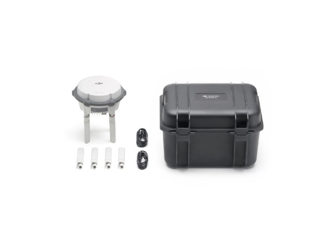
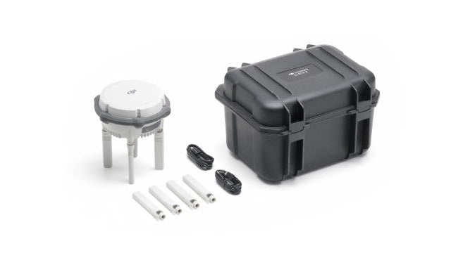
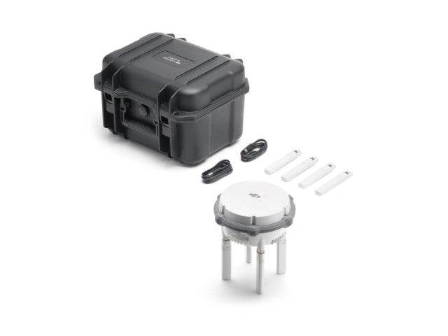
D-RTK 3 Multifunctional Station
D-RTK 3 Multifunctional Station
SKU:CP.EN.00000551.01
Couldn't load pickup availability
D-RTK 3 Multifunctional Station: Revolutionizing High-Precision Positioning for Enterprise Operations
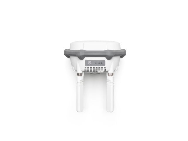
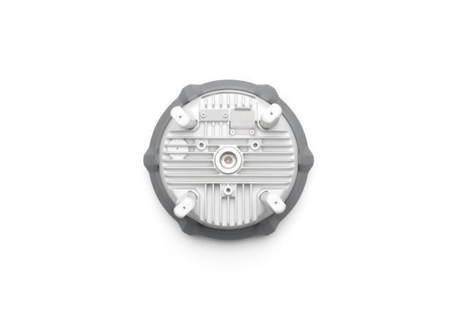
The DJI D-RTK 3 Multifunctional Station represents the next step in high-precision positioning and data transmission technology, built to support a variety of enterprise applications. Whether you're performing aerial surveys, mapping key areas, or expanding operational range, the D-RTK 3 serves as a dependable foundation for seamless, accurate, and efficient performance.
Benefits and Features
1. Three Operating Modes for Diverse Applications
The D-RTK 3 provides exceptional flexibility with three unique modes:
- Base Station Mode: Achieve centimeter-level positioning for multiple drones at once. Equipped with the new O4 Enterprise video transmission system and four external directional antennas, the station supports up to 15 km of video transmission in broadcast mode. Its omnidirectional signal stability guarantees reliable performance in large-scale operations.
- Relay Station Mode: Increase the operational range of your drones up to 25 kilometers. This mode improves video transmission in areas with typically weak signal strength, including urban settings, mountainous regions, or dense valleys.
- Rover Station Mode: Enhance the accuracy of your UAV aerial surveys by gathering precise control point coordinates. This feature greatly boosts mapping and survey precision, ensuring your results are both reliable and actionable.
2. Unrivaled High-Precision Positioning
Powered by advanced technology, the D-RTK 3 sets a new standard for accuracy:
- Advanced Satellite Tracking: Utilizing its air dielectric antenna and specialized filtering design, it tracks low-elevation satellites, ensuring millimeter-level phase-center accuracy, even in challenging environmental conditions.
- Multi-System Support: It receives data from five major satellite systems (GPS, GLONASS, Galileo, BeiDou, and QZSS) across 19 frequency points, providing exceptional positioning accuracy that surpasses traditional network RTK solutions.
- Standalone Precise Point Positioning (PPP): DJI's exclusive PPP technology allows for satellite-based automatic convergence, providing decimeter-level positioning without depending on network conditions.
- Network High-Precision Calibration: With RTCM data input, the station automatically calibrates coordinates to achieve centimeter-level precision, eliminating the need for pre-measuring the setup point and simplifying deployment.
3. Integrated Surveying and Mapping Workflow
The D-RTK 3 revolutionizes your approach to mapping and surveying tasks:
- Streamlined Ground Control Point Collection: Compatible with the DJI Enterprise app, it enables direct measurement of control point coordinates without the need for third-party equipment.
- Efficient Surveying Integration: When used with DJI RTK-enabled drones, the system supports a complete high-precision surveying workflow, from data collection to map creation.
- Tilt Compensation for Complex Environments: The station is equipped with a widely used projection coordinate database, allowing for seamless output of planar coordinates and simplifying the mapping process.
Unrivaled Reliability for Essential Missions
Engineered to meet enterprise requirements, the D-RTK 3 thrives in challenging environments. With its durable construction, accurate satellite tracking, and adaptable modes, it is the perfect choice for professionals in surveying, infrastructure inspections, search and rescue, and beyond.
Enhance your operations with the DJI D-RTK 3 Multifunctional Station, where precision and reliability converge.
Share